Aerial Photography Products - AeroHELLAS Basic
Aerial photographs constitute the raw information from which high quality and accuracy vector or raster basemaps can be produced, through proper elaboration in analytical and digital photogrammetric systems.
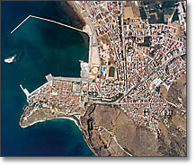
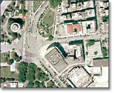
Aerial photographs acquired by our aircrafts aim to cover our clients' needs or to enrich the company's aerial photography archive, which currently covers cities and villages, roads, important tourist sites as well as areas of high development rate or of special interest.
For private users or professional users who are looking for simple aerial photographs for non-surveying purposes, the following aerial photography products are available, in either digital or analogue form:
- Aerial photography contact prints, in 23x23 cm format, colour or B/W, in various scales.
- Polyester film diapositives for photogrammetric applications.
- Aerial photographs in digital form and various resolutions for common use (photo-interpretation, land use analysis, registrations)
- Multispectral digital aerial photographs (R, G, B, NIR)
- High geometrical and radiometric quality digital images, for photogrammetric plotting, at resolutions of up to 3.500 dpi, in various formats (TIFF uncompressed, JPEG 2000).
- Aerial photographs' enlargements in various sizes (from 2x up to 20x)
- Aerial photographs' posters of the chosen area of interest.


